Standard Vehicle Tracking Package

24/7 tracking and control with high levels of positioning sensitivity and accuracy

A new generation vehicle tracking solution, offering advanced features of high location sensitivity and accuracy. With the Standard Vehicle Tracking Package;

  • Track your vehicles 24/7 in real-time and retroactively,
  • Set speed limit, define route and region,
  • Receive instant alerts on personalized, pre-defined indicators,
  • Access current and retroactive reports on your vehicles and drivers.
<

Standard Vehicle Tracking Package includes;

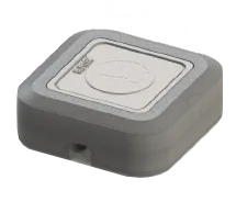
  • Vehicle Tracking Device
  • Vehicle Tracking and Fleet Management Software
  • Licensed Digital Maps


Package Features

● Real-time vehicle tracking

● Push notifications and alerts

● Monitoring start and end points 

●Monitoring trip time and distance 

● Updated maps where live traffic data can be seen

● Customizable reports, descriptive dashboard

● Easy-to-use mobile appRS.


MODEL
imt.K12
DIMENSIONS
65 mm x 56;6 mm x 20,6 mm
OPERATING TEMPERATURE
-40 C ile +85 C
WEIGHT
55 gr (3)
DATA STORAGE
128 MB
BATTERY TYPE
Li-Ion 170 mAh 3.7 V
POWER
10-30 VDC
• Average 35 mA (12 V input (1)
• Sleep 11 mA (12 V input (1)
• Peak 1:5 mA (12V input (2)

GSM ANTENNA
Built-in
GPS ANTENNA
Built-in
SENSORS
6D Acceleration/G Sensor (for motion, acceleration and accident detection)
GSM MODEM
4 Band 2G:
GPS RECEIVER
SBAS L1 C/A: WAAS, EGNOS,MSAS, GAGAN
GNSS Support, AGNSS Support
Accuracy: GPS 2,5 m, GPS+SBAS 2.0 m
Receiver Type:
• Number of Channels: 72
• Frequency: L1
• Signals: GPS C/A Code, GLONASS L10F
• Configuration:
Navigation update rate: up to 10 Hz
Time-To-First-Fix 4
• Cold Start :356 sn
• Reacquisition: 1 sn
• Aided Start /5) : 1 sn
Receiver Input Sensitivity (6)
• Tracking and Navigation : -165 dBm
• Re-locking : -157 dBm
• Cold Start : -148 dBm
Accuracy
• Horizontal Position (7) : < 2.5 m CEP
Limits
• Acceleration : 4 g
• Altitude (8) : 50000 m
• Speed (8) : 500 m/s
LED INDICATORS
GSM LED:
Blinking every second - Normal mode
Off - Device is not working
GNSS LED:Blinking every second - Normal mode 
Permanently switched on - No GNSS signal
GPRS
• GPRS Multi-slot Class 10
• Mobile Station Class B
• Coding Scheme CS1-CS4
• PBCCH Support
• SMS Support
• Echo Suppression and Noise Reduction
• Micro SIM Card Slot
INPUT-OUTPUT SLOTS
• Digital Input x 3
• Digital Output x 2
• Analog Input x 2
• 1-Wire x 1
• Can Adapter Input x 1
• 
Micro-SIM
TACT SWITCH
Case-open detection
CERTIFICATES


(1) With 2G module
(2) With LTE module
(3) In non-battery operated use
(4) All GPS satellites signal level minimum -130 dBm
(5) Assisted GPS, depends on data link speed and delay
(6) Measured with a high-performance active antenna
(7) CEP, % 50, 24 h static, -130 dBm, SEP: <3.5 m
(8) Air platform acceleration taken as <4g

Advanced Software Applications

Never lose track of your vehicles with Web/Desktop Software and mobile applications specifically designed and compatible with iOS, Android devices.
  • Web-based Application
  • Desktop Application
  • Smartphone and Tablet Applications

Arvento Web-based Application

Arvento‘s easy-to-use web based interface, can be accessed with a user name and password from any internet enabled PC through www.arvento.com.The simple interface enables users to access their vehicle tracking and fleet management and monitoring system with digital maps hosted on the web server.

Arvento Desktop Application

Once installed on the user’s PC, Arvento desktop solution allows the download of digital maps for offline use. As only the data from the devices is received via the Internet, it operates fast and effectively even with low bandwidth internet connections.

Smartphone and Tablet Applications

Vehicles can be monitored in real time on the digital maps with Arvento’s mobile applications specifically designed and compatible with Windows Phone, iPhone/iPad (iOS), Android and Huawei based devices. Users can easily access reports, get notifications, alerts and warning messages and monitor vehicles through the mobile applications.

Licensed Digital Maps

Detailed World maps on your screen

Digital maps, integrated into Arvento’s software and applications, are updated throughout the subscription period at no additional charge. Furthermore, users can customize digital maps by adding key locations, such as office locations, POIs and more.

Optional Sensors and Additional Units

Add extra features to your system with optional sensors and additional units that are compatible with imt.X1 Vehicle Tracking Device

Mobile NVR-DVR

Mobile NVR-DVR is a functional Mobile Digital Video Recorder, specifically designed for vehicle video surveillance and remote monitoring. This unit  enables online access to audio-visual recordings. Previously captured images are also stored and can be downloaded to be viewed when required. 

Driver Identification Units

The units enable users to monitor distance travelled and hours driven by a particular driver. The drivers insert their special identification card or use the special buttons or passwords to operate the unit.

Fuel Tank Safety Sensors

Sensors on fuel tank lids monitor lid opening times at each location and send an  alert when the lid is opened within areas defined for fuel siphoning.